
Building Volume Mapping Using Open Datasets
Published:
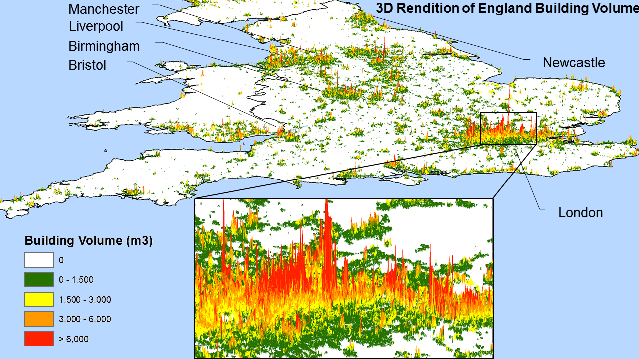
Cities grow in 3D space. But urban remote sensing capabilities in the vertical dimension have been limited by data availability. Is it possible to characterize urban 3D structure using open datasets (such as Landsat and global DSMs)?
In this study, I found that the synergy of freely available datasets could indeed be used for characterizing urban 3D structure at large scale. Although data quality and availability issues need to be addressed, we can still map a great amount of spatial details with innovative machine learning techniques.
The dataset is available via:
Wang, Panshi; Huang, Chengquan, 2018, “30m Building Height/Volume of England Based on the Synergy of free elevation and Landsat Data”, http://dx.doi.org/10.7910/DVN/NNUDZG, Harvard Dataverse, V1
Stay tuned for more updates about this research.